


Le val

frizou83
User
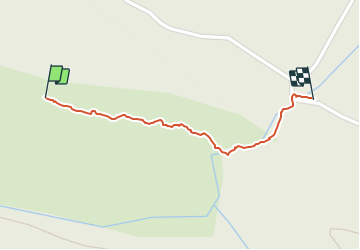

Length
602 m

Max alt
431 m

Uphill gradient
0 m
Km-Effort
915 m

Min alt
332 m

Downhill gradient
94 m
Boucle
No
Creation date :
2021-06-06 12:28:48.0
Updated on :
2021-06-06 12:49:49.27
21m
Difficulty : Easy

FREE GPS app for hiking
 SityTrail
IGN / Geographical institutes
SityTrail Plus
The world is yours!
About
Trail Walking of 602 m to be discovered at Provence-Alpes-Côte d'Azur, Var, Le Val. This trail is proposed by frizou83.
Positioning
Country:
France
Region :
Provence-Alpes-Côte d'Azur
Department/Province :
Var
Municipality :
Le Val
Location:
Unknown
Start:(Dec)
Start:(UTM)
261187 ; 4815519 (32T) N.
Comments